Initializing, please wait a moment
Kapan memakai Celestial Coordinate Systems 3D Explorer
Use this explorer when you need to see how a published RA/Dec position relates to what is actually above your horizon - and skip it when you only want star patterns or the Sun path.
- Classroom demos of why stars rise and set while their RA/Dec stay fixed
- Showing how the celestial pole altitude equals the observer latitude
- Introducing the 23.44 degree obliquity of the ecliptic
This is an educational grid visualization at the J2000 epoch, not a live star catalog or planetarium.
Angka utama koordinat langit
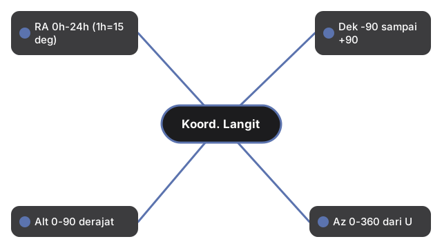
Angka utama koordinat langit dalam satu tampilan: Coordinate Systems Sky menampilkan asensio rekta 0h-24h, deklinasi -90 sampai +90 deg, plus altitude dan azimut untuk kerja horizon.
| Koordinat | Rentang |
|---|---|
| Asensiorekta (RA) | 0h-24h ke timur (1h = 15 derajat) |
| Deklinasi (Dek) | -90 hingga +90 derajat |
| Altitud (Alt) | 0-90 derajat |
| Azimut (Az) | 0-360 derajat dari Utara |
| Kemiringan ekliptika | 23,44 derajat (J2000) |
Walk the controls in the step-by-step guide, or compare options in vs alternatives. Open the Celestial Coordinate Systems 3D Explorer.