
Two coordinate grids map the same sky: the star-fixed equatorial grid (Right Ascension / Declination) and your observer-fixed horizontal grid (Altitude / Azimuth), tilted apart by your co-latitude.
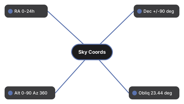
Published literacy: RA 0h-24h eastward (1h = 15 deg); Dec -90 to +90 deg; Alt 0-90 deg; Az 0-360 deg from North; obliquity of the ecliptic 23.44 deg (J2000).
Drag to orbit and scroll or pinch to zoom. Toggle the equatorial grid, horizontal grid, or ecliptic, pause the diurnal spin, or move the latitude slider to tilt your horizon.
Celestial Coordinate Systems 3D Explorer
FreetoolOnline editorial teamThe Celestial Coordinate Systems 3D Explorer draws the two grids astronomers use to place anything in the sky: the star-fixed equatorial grid (Right Ascension and Declination) and your observer-fixed horizontal grid (Altitude and Azimuth).
Right Ascension runs 0h to 24h eastward from the March equinox, where 1 hour equals 15 degrees, and Declination runs -90 degrees at the south celestial pole to +90 degrees at the north. Altitude runs 0 degrees at the horizon to 90 degrees at the zenith, and Azimuth runs 0 to 360 degrees clockwise from true North.
The two grids tilt apart by your co-latitude: the celestial pole sits at an altitude equal to your latitude, so at 40 degrees North the north celestial pole is 40 degrees above the northern horizon. The ecliptic - the Sun path - is drawn tilted by the obliquity of 23.44 degrees to the celestial equator.
- Blue equatorial grid: celestial equator, declination parallels, hour circles, both celestial poles
- Amber horizontal grid: horizon, altitude circles, azimuth lines, zenith, and the N/E/S/W cardinal points
- Green ecliptic tilted 23.44 degrees, plus the vernal equinox point and Polaris near the north celestial pole
- Latitude slider tilts your horizon so you can see the pole rise and fall
- Pausable diurnal spin: the star-fixed grid wheels about the pole while the horizon stays put
- Runs fully in the browser with the vendored three.js engine - no account, no upload
Students see why a star rises and sets while its RA/Dec never change; teachers contrast the star-fixed catalog frame with the observer-fixed sky; curious readers connect a published position to what is actually above them.
| Figure | Value | Source note |
|---|---|---|
| Right Ascension range | 0h to 24h (1h = 15 deg) | Measured eastward from the March equinox |
| Declination range | -90 deg to +90 deg | Celestial equator = 0 deg |
| Altitude / Azimuth | 0-90 deg / 0-360 deg | Azimuth clockwise from true North |
| Obliquity of the ecliptic | 23.44 deg | J2000 (IAU); drifts slowly |
| Polaris declination | +89 deg 16 min | About 0.7 deg from the north celestial pole (J2000) |
Everything renders on your device with WebGL. The 3D engine loads once (about 0.7 MB) and is cached; no scene data is sent to a server.
This is an educational coordinate-grid visualization at a fixed epoch (J2000) - it draws the grids and reference circles, not a live star catalog or a planetarium ephemeris.
For a step-by-step walkthrough, read the Celestial Coordinate Systems 3D Explorer step-by-step guide. The Space 3D collection also includes Constellation Sphere 3D and Ecliptic and Zodiac 3D.
Frequently Asked Questions
What is the difference between equatorial and horizontal coordinates?
Equatorial coordinates (Right Ascension and Declination) are fixed to the stars, so a star keeps the same RA/Dec all night. Horizontal coordinates (Altitude and Azimuth) are fixed to you, so the same star changes Alt/Az minute by minute as the sky turns.
Why do the two grids tilt apart?
The celestial pole sits at an altitude equal to your latitude. So the star-fixed grid is tilted from your horizon by your co-latitude (90 degrees minus your latitude). The latitude slider shows this directly.
What is Right Ascension measured in?
Hours, from 0h to 24h, measured eastward along the celestial equator from the March equinox. One hour of RA equals 15 degrees, since the sky turns 360 degrees in 24 hours.
Where is the ecliptic and why is it tilted?
The ecliptic is the Sun apparent yearly path. It is tilted 23.44 degrees to the celestial equator because Earth axis is tilted by that obliquity. This scene draws it in green.
Is Polaris exactly at the north celestial pole?
No. Polaris sits at declination about +89 degrees 16 minutes, roughly 0.7 degrees off the true north celestial pole - close enough to be a useful marker, but not exact.
Does this show real-time star positions?
No. It draws the coordinate grids and reference circles at the J2000 epoch for learning. It is not a live star catalog or a planetarium ephemeris.