
Toggle between LEO, MEO, GEO, Molniya, and Sun-synchronous orbits to see why a GPS satellite, a weather satellite, and the International Space Station all live at completely different altitudes - drag to orbit and read the published altitude, period, and inclination for each band in the panel.
All five bands orbit at once, each at a speed proportional to its real published period - watch Low Earth Orbit lap the planet more than fifteen times while Geostationary barely creeps, because a satellite parked there must match Earth's own rotation exactly.
Drag to orbit and scroll or pinch to zoom. Click a button to highlight one band and read its row in the comparison table.
Related orbit explorers: ISS Orbit Tracker (one real spacecraft's live-style ground track), Hohmann Transfer 3D Explorer (the burns that move a satellite between two of these bands), and Kepler Orbits 3D Explorer (why orbits are ellipses in the first place). Walk the step-by-step guide.
Satellite Orbit Classes 3D Explorer
This explorer lines up the five orbit bands real satellites actually use - LEO, MEO, GEO, Molniya, and Sun-synchronous - each animating at a speed set by its own published orbital period, so the reason a GPS satellite and a weather satellite live thousands of kilometers apart becomes visible instead of abstract.
Selecting a band highlights its ring and satellite marker and pulls up its row in the comparison table below; all five keep orbiting at once so the size difference between a 92-minute lap and a 24-hour lap stays visible the whole time. This page compares the five bands side by side - for one real spacecraft's live-style ground track see ISS Orbit Tracker, for the burns that move a satellite between two bands see Hohmann Transfer 3D Explorer, and for why orbits are ellipses at all see Kepler Orbits 3D Explorer.
- Five orbit bands rendered at once - LEO, MEO, GEO, Molniya (HEO), and Sun-synchronous
- Each satellite marker moves at a speed proportional to its real published orbital period
- Selector buttons highlight one band and open its row in the facts panel
- Comparison table lists altitude, period, inclination, and a real example satellite per band
- Runs in-browser with three.js - no account, no upload
Molniya's ellipse looks the most unusual of the five: it lingers near apogee over high latitudes for hours before racing through a low, fast perigee on the other side of the planet, which is exactly why Russia has flown that orbit for high-latitude communications since 1964.
| Orbit class | Altitude | Period | Inclination | Real example |
|---|---|---|---|---|
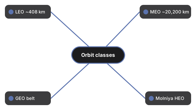
| LEO | ~408 km (varies 400-420 km) | 92.68 min | 51.6 deg | International Space Station |
| MEO | ~20,200 km | 11h 58m | 55 deg, 6 planes | GPS constellation |
| GEO | 35,786 km (42,164 km from Earth's center) | 23h 56m 4s | 0 deg | Weather / TV broadcast satellites |
| Molniya (HEO) | perigee ~500-600 km, apogee ~40,000 km | 11h 58m | 63.4 deg | Russian Molniya comms satellites |
| Sun-sync (SSO) | ~600-800 km | 96-100 min | 98 deg, retrograde | Landsat Earth-observation satellites |
This is an educational visualization, not a precision orbital-mechanics simulation - Earth and the satellite markers are enlarged so they stay visible, and each ring's radius is plotted close to its real ratio to Earth's own radius rather than compressed the way a whole-solar-system scene needs to be.
Renders on-device with WebGL - loads once (about 0.7 MB), cached by the browser, no data sent to a server.
Geostationary orbit sits at exactly 35,786 kilometers because that is the only altitude where a circular orbit's period matches Earth's own rotation - 23 hours, 56 minutes, and 4 seconds, one sidereal day. Any lower and the satellite would lap the planet faster than the ground beneath it; any higher and it would fall behind, drifting slowly across the sky instead of holding one fixed point.
For the walkthrough, see the step-by-step guide. The Space 3D collection also includes ISS Orbit Tracker and Hohmann Transfer 3D Explorer.
Frequently Asked Questions
What does the Satellite Orbit Classes 3D Explorer show?
Five real orbit bands - LEO, MEO, GEO, Molniya, and Sun-synchronous - rendered around Earth at once, each satellite marker moving at a speed proportional to its real published period. Click a button to highlight one band and read its facts.
How is this different from ISS Orbit Tracker?
ISS Orbit Tracker follows one real spacecraft's live-style ground track in detail. This page compares five different orbit families against each other side by side.
Why does a GPS satellite orbit so much higher than the ISS?
GPS satellites fly in Medium Earth Orbit at about 20,200 km so a small constellation of 24+ satellites can each cover a huge slice of the globe. The ISS stays low (~408 km) because it is easier and cheaper to reach and resupply.
Why does Molniya use such a stretched-out ellipse?
A geostationary satellite over the equator has poor coverage of high latitudes. Molniya's eccentric orbit lingers for hours near its ~40,000 km apogee over the far north, then swings quickly through a low ~500-600 km perigee - the tradeoff Russia chose since 1964.
What makes an orbit "Sun-synchronous"?
A Sun-synchronous orbit's plane precesses by about one degree per day, exactly matching Earth's motion around the Sun, so a satellite like Landsat crosses the equator at the same local solar time on every pass - useful for comparing images taken months apart.
Is this scene to real relative scale?
The ring radii are plotted close to their real ratio to Earth's radius, which is honest at this scale (unlike a whole-solar-system scene). Earth itself and the satellite markers are enlarged so they are visible - a real satellite is far too small to see at this distance.
Why does GEO barely seem to move?
A satellite in GEO orbits once every 23h56m4s - the same time Earth takes to rotate once - so from the ground it appears to hang over one fixed point. In this scene it still completes a full lap, just far slower than LEO or MEO.