
New Horizons found Charon fractured by pull-apart chasms. Serenity Chasma is more than 200 kilometers long and about 5 to 7 kilometers deep, part of a tectonic belt stretching roughly 1,800 kilometers. Press play to spin Charon, face the canyon, and toggle a cutaway that hints at the frozen-ocean expansion story.
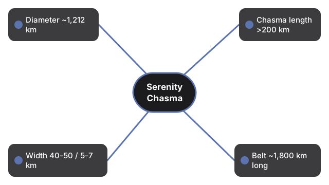
Published figures: Charon diameter ~1,212 km; Serenity Chasma >200 km long, ~40-50 km wide, ~5-7 km deep; equatorial chasm belt ~1,800 km long, up to ~7.5 km deep; New Horizons July 2015 (NASA).
Drag to orbit and scroll or pinch to zoom. Press Play or toggle Ocean hint.
Charon Serenity Chasma 3D Explorer
Charon is Pluto's largest moon - about 1,212 kilometers across. When New Horizons flew by in July 2015, it revealed a belt of pull-apart tectonic faults cutting the encounter hemisphere. One prominent segment, informally called Serenity Chasma, is more than 200 kilometers long, typically 40 to 50 kilometers wide, and about 5 to 7 kilometers deep. The wider chasm system runs at least about 1,800 kilometers and reaches depths near 7.5 kilometers in places - far longer and deeper than Earth's Grand Canyon.
NASA scientists interpret the fractures as evidence that Charon once had a subsurface water ocean that later froze and expanded, stretching and cracking the icy crust. That ocean story is a scientific hypothesis grounded in the fault morphology - this explorer shows the canyon geometry and an optional schematic interior hint, not a thermal-evolution model.
- Charon with a schematic Serenity Chasma canyon belt
- Optional ocean-freeze expansion hint under the crust
- Scale comparison to Grand Canyon figures in the facts panel
- Speed slider and Play/Pause rotation
- Runs fully in the browser with the vendored three.js engine - no account, no upload
Anyone comparing giant canyons across the Solar System gets a concrete sense of how an icy moon can crack on a planetary scale.
| Figure | Value | Source note |
|---|---|---|
| Charon diameter | ~1,212 km | NASA / New Horizons |
| Serenity Chasma length | >200 km | Informal name; New Horizons |
| Serenity width / depth | ~40-50 km / ~5-7 km | Published summaries |
| Chasm belt length / depth | ~1,800 km / up to ~7.5 km | NASA photojournal |
| Grand Canyon (compare) | ~446 km / ~1.6 km | NASA comparison text |
| Flyby | 14 July 2015 | New Horizons |
Everything renders on your device with WebGL. The 3D engine loads once (about 0.7 MB) and is cached; no scene data is sent to a server.
This is an educational visualization - Charon is a smooth sphere, the chasma is a schematic trench, and the ocean hint is illustrative of the freeze-expansion idea, not a full interior model. Serenity Chasma remains an informal name in many sources.
For a step-by-step walkthrough, read the Charon Serenity Chasma 3D Explorer step-by-step guide. The Space 3D collection also includes Miranda Verona Rupes 3D Explorer and Vesta Rheasilvia Basin 3D Explorer for related giant-feature context.
Frequently Asked Questions
How big is Serenity Chasma?
More than 200 kilometers long, typically about 40 to 50 kilometers wide, and roughly 5 to 7 kilometers deep - part of a ~1,800 kilometer chasm belt.
Is Serenity Chasma an official name?
It is widely used but often listed as informal, named after the ship Serenity from Firefly. The broader tectonic belt is the main mapped system.
Why did Charon crack?
NASA's leading idea is that an ancient subsurface ocean froze and expanded, stretching the crust into pull-apart faults. That remains a scientific interpretation.
How does it compare with the Grand Canyon?
NASA notes the Charon chasm belt is far longer (~1,800 km vs ~446 km) and deeper (up to ~7.5 km vs ~1.6 km).
When was it imaged?
New Horizons imaged the encounter hemisphere during the July 14, 2015 flyby.
Is the ocean still liquid?
The hypothesis is that the ocean has long since frozen. The scene ocean hint is schematic history, not a present-day liquid layer claim.
Is this a physics simulation?
No. It is an educational visualization with compressed canyon relief, not a tectonic or freeze solver.