
Iapetus wears a mountain chain along its equator - a ridge about 1,300 kilometers long with peaks up to about 20 kilometers high that give the moon a walnut outline. Press play to spin the two-tone moon, face the ridge edge-on, and toggle a half-and-half albedo view of bright trailing ice versus dark Cassini Regio.
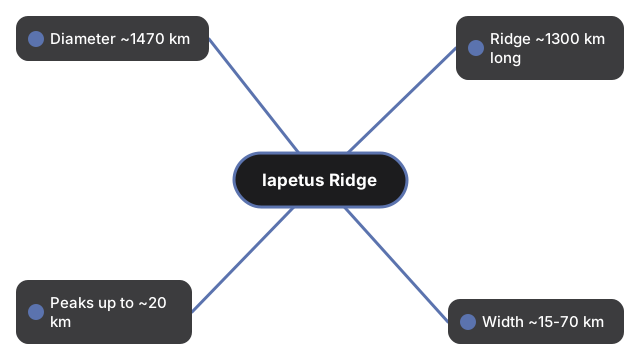
Published figures: Iapetus diameter ~1,400-1,470 km; equatorial ridge ~1,300 km long, peaks up to ~20 km; width often cited ~15-70 km; Cassini imaged clearly 31 Dec 2004 (NASA/JPL).
Drag to orbit and scroll or pinch to zoom. Press Play or toggle Albedo.
Iapetus Equatorial Ridge 3D Explorer
Iapetus is Saturn's third-largest moon - about 1,400 kilometers across in NASA summaries, with more precise mean diameters near 1,470 kilometers in modern shape models. Cassini first clearly imaged a seam of mountains almost exactly on the equator on 31 December 2004. That equatorial ridge runs roughly 1,300 kilometers, with peaks rising up to about 20 kilometers above the plains - among the tallest mountain structures in the Solar System for such a small body - and gives Iapetus its famous walnut silhouette.
The moon is also famously two-toned: a dark leading hemisphere (Cassini Regio) and a bright icy trailing side. Ridge origin is still debated - ideas range from internal tectonics to accretion of an ancient ring onto the equator - so this page shows the ridge geometry and albedo contrast without picking a single formation story.
- Walnut-shaped Iapetus with a schematic equatorial ridge
- Toggleable dark/bright hemisphere contrast
- Edge-on ridge view for height scale
- Speed slider and Play/Pause rotation
- Runs fully in the browser with the vendored three.js engine - no account, no upload
Anyone comparing giant mountains on tiny worlds gets a concrete sense of a ridge taller than Everest wrapped around an icy moon.
| Figure | Value | Source note |
|---|---|---|
| Iapetus diameter | ~1,400-1,470 km | NASA JPL ~1400 km; shape models ~1470 km |
| Ridge length | ~1,300 km | Cassini / NASA |
| Ridge peak height | up to ~20 km | NASA/JPL |
| Ridge width | ~15-70 km (range) | Published summaries vary |
| Clear imaging | 31 Dec 2004 | Cassini |
| Discovery of moon | 1671 | G. D. Cassini |
Everything renders on your device with WebGL. The 3D engine loads once (about 0.7 MB) and is cached; no scene data is sent to a server.
This is an educational visualization - the ridge height is exaggerated for readability, the body is a smooth sphere plus torus seam, and albedo is a simple half-and-half sketch, not a Cassini mosaic.
For a step-by-step walkthrough, read the Iapetus Equatorial Ridge 3D Explorer step-by-step guide. The Space 3D collection also includes Charon Serenity Chasma 3D Explorer and Miranda Verona Rupes 3D Explorer for related giant-feature context.
Frequently Asked Questions
How tall is the equatorial ridge?
Peaks rise up to about 20 kilometers above the surrounding plains along a ridge about 1,300 kilometers long.
Why does Iapetus look like a walnut?
The equatorial mountain chain bulges the silhouette at the equator, which Cassini images made unmistakable.
What causes the two-tone colors?
A dark leading hemisphere (Cassini Regio) contrasts with a bright icy trailing side. Thermal and dust-migration ideas are discussed in the literature; this page shows the contrast schematically.
How did the ridge form?
Origin is debated - internal tectonics versus accretion of an ancient ring are leading ideas. This explorer does not pick one.
When was the ridge discovered?
Cassini first clearly imaged it on 31 December 2004; Voyager had hinted at equatorial mountains earlier.
Is the ridge continuous all the way around?
It spans most of the equator in segments of peaks and parallel ridges, not a perfect unbroken wall.
Is this a physics simulation?
No. It is an educational visualization with exaggerated ridge relief, not a formation model.