Earth 3D Globe vs Desktop Virtual Globe Apps
freetoolonline.com editorial team
The Earth 3D Globe does one thing instantly in your browser: show the real day/night state of the planet from your device's clock. Desktop virtual-globe applications and online satellite map services do far more - and cost far more to start. Here is the honest comparison.
The numbers side by side
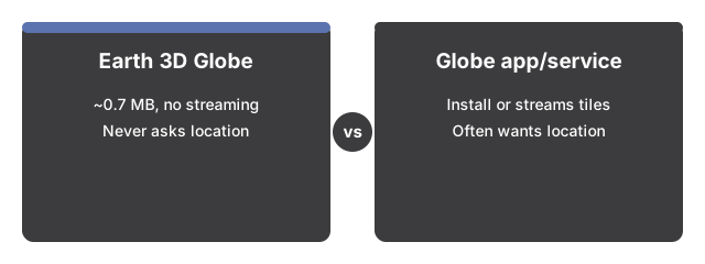
The numbers below put the Earth 3D Globe side by side with its alternatives at a glance.

| Aspect | Earth 3D Globe on this page | Typical virtual-globe app or map service |
|---|---|---|
| Install / download | 0 MB - a 0.7 MB engine loads once, then stays cached | An install of hundreds of MB, or continuous tile streaming |
| Network use after load | None - the map is drawn from data embedded in the page | Streams imagery tiles as you pan and zoom |
| Location access | Never requested | Often requested for the my-location features |
| What you see | Real coastlines + the live day/night line | Satellite imagery, streets, labels, terrain |
Where this globe wins
Earth 3D Globe wins on speed and privacy. The question "where is it day right now" is answered seconds after the page opens, on any device with a browser, with no account and no location permission - the only input is your system clock.
Where a full virtual globe still wins
A full virtual globe still wins on detail. Earth 3D Globe is a stylized vector map - simplified public-domain Natural Earth coastlines with a 30-degree grid, no borders, no city labels, no terrain, no search. A virtual-globe app or satellite viewer is the better pick when you need that depth.
The practical rule
As a practical rule, open this globe to check day and night, preview dawn and dusk, or demo the terminator to a class. Open a virtual-globe app when you need imagery, streets, or search.
For every control in order, see the Earth globe step by step.
For the moments this page is the right choice - and when a full map service makes more sense - see when to use the Earth 3D Globe.
Why trust these tools
- Ten-plus years of web tooling. The freetoolonline editorial team has shipped browser-based utilities since 2015. The goal has never changed: get you to a working output fast, without an install.
- No install, no sign-up. Open a tool and get a working output in seconds - nothing to download and no account to create. Tools that need heavy processing run it on our service, so even a low-powered machine gets the job done.
- Analytics stops at the page view. We measure which pages get visited, not what you type or upload inside a tool. There is nothing to sign in to and no profile is attached to your input.
- Open-source core components. The processing engines underneath (libheif, libde265, pdf-lib, terser, clean-css, ffmpeg.wasm, and others) are public and audit-able. We link to each one in its tool page's footer.
- Free, with or without ads. All tools are fully functional without sign-up. The Disable Ads button in the header is always available if you need a distraction-free run.