Initializing, please wait a moment
Quando usar Celestial Coordinate Systems 3D Explorer
Use this explorer when you need to see how a published RA/Dec position relates to what is actually above your horizon - and skip it when you only want star patterns or the Sun path.
- Classroom demos of why stars rise and set while their RA/Dec stay fixed
- Showing how the celestial pole altitude equals the observer latitude
- Introducing the 23.44 degree obliquity of the ecliptic
This is an educational grid visualization at the J2000 epoch, not a live star catalog or planetarium.
Numeros principais das coordenadas celestes
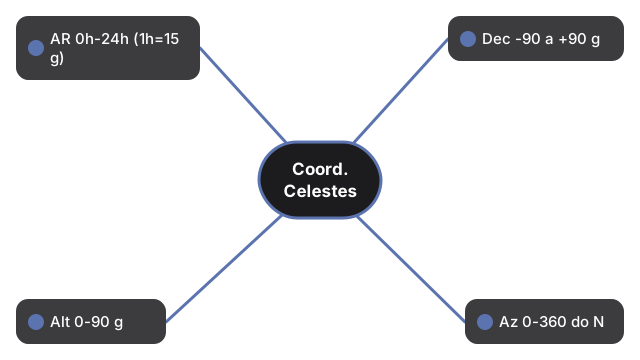
Numeros principais das coordenadas celestes em uma vista: Coordinate Systems Sky mostra ascensao reta 0h-24h, declinacao -90 a +90 deg, mais altitude e azimute para trabalho no horizonte.
| Coordenada | Faixa |
|---|---|
| Ascensao Reta (AR) | 0h-24h para leste (1h = 15 graus) |
| Declinacao (Dec) | -90 a +90 graus |
| Altitude (Alt) | 0-90 graus |
| Azimute (Az) | 0-360 graus a partir do Norte |
| Obliquidade da eclipitica | 23,44 graus (J2000) |
Walk the controls in the step-by-step guide, or compare options in vs alternatives. Open the Celestial Coordinate Systems 3D Explorer.