When to Use the Live Wildfire Map (and When Not To)
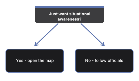
The live wildfire map answers one question well: which US fires are burning right now, how big they are, and how contained. Reach for it for situational awareness; do not reach for it for evacuation decisions - the reasons are below.
Good reasons to open it
You can smell or see smoke. Filter to your state, press the distance sort, and the nearest incidents top the list with acres and containment - a fast answer to "is something burning near me, and how serious is it". Remember smoke often travels from fires hundreds of miles away, so pair it with the air quality checker.
You are planning travel through fire country. Set the size floor to 1,000+ acres and check the states on your route. Large, poorly contained fires are the ones that close roads and parks.
Family or property in another state. The state menu with live incident counts shows at a glance whether their state is quiet or busy, and the county column pins each fire down.
Following the season. The all-states view with the prescribed-burns toggle shows the national picture: where the big campaign fires are, and where land managers are doing planned burns (the grey dots).
When NOT to use it
Evacuation decisions. Incidents reach the federal feed on agency reporting cadence - hours of delay are normal. If a fire threatens you, follow local officials and official alert channels, not any map.
Fires outside the US. The NIFC WFIGS feed is the US interagency system; other countries' fires do not appear.
Perimeter shapes or satellite hotspots. The page plots incident point locations. If you need mapped fire perimeters or satellite detection layers, an agency GIS dashboard is the right tool - the trade-offs are in the comparison guide.
The privacy angle
Everything loads in your browser from a public, keyless federal feed. Location is requested only if you press the distance button, is used once in the tab, and is never stored or sent anywhere. New here? Start with the step-by-step walkthrough.
Why trust these tools
- Ten-plus years of web tooling. The freetoolonline editorial team has shipped browser-based utilities since 2015. The goal has never changed: get you to a working output fast, without an install.
- No install, no sign-up. Open a tool and get a working output in seconds - nothing to download and no account to create. Tools that need heavy processing run it on our service, so even a low-powered machine gets the job done.
- Analytics stops at the page view. We measure which pages get visited, not what you type or upload inside a tool. There is nothing to sign in to and no profile is attached to your input.
- Open-source core components. The processing engines underneath (libheif, libde265, pdf-lib, terser, clean-css, ffmpeg.wasm, and others) are public and audit-able. We link to each one in its tool page's footer.
- Free, with or without ads. All tools are fully functional without sign-up. The Disable Ads button in the header is always available if you need a distraction-free run.